
Pennine Way (250 miles) 1984
… or 270 miles if you prefer Wainwright.
This was the one I really wanted to do. Stu agreed. This was slated as the hardest of the trails in the UK/Britain. It still is.
And it lives up to its reputation.
We started as group of 2 (Me & Stu) leaving Edale, full of trepidation. We finished as a group of 10 at Kirk Yetholm two weeks later.
The whole walk was magnificent. The good news was that it was a hot summer – it didn’t rain for the whole fortnight of hiking. Unheard of in the Pennines and Cheviots.
The people we met fell into two camps – the Wainwright lovers and the Wainwright haters. I think it was fashionable to dislike Wainwright’s guide at the time. All I can say is that it worked for me, and each page had something interesting to say about the route. The author’s concluding notes are well worth a read. And I got to read page 4 (“reserved for heroes”)!

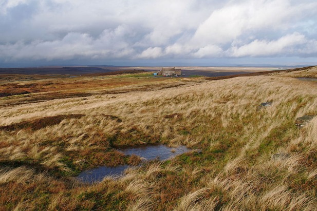
(the colours are added by me).
There is so much variety along the way. I have listed my highlights below.
Kinder Scout – 2 miles across the peat plateau. There are ditches (“groughs”) up to 3 metres deep where the rain has washed the peat away. These go in all directions. There are two choices….try to go in a straight line by compass, which is exhausting as you climb and descend innumerable peat mounds between the groughs OR follow the groughs and try to keep in roughly the right direction. Having chosen the second option it was sobering to reach the edge of the plateau 1 mile from our intended destination (and it is only 2 miles across). It is no wonder people have died on Kinder.
Black Hill – Another peat mass, aptly named. Memorable to me as I met a guy from the army at the top, while I was trying to work out the direction off the top using my compass. He taught me in 2 minutes how to compensate for magnetic declination (the adjustment to make because North on the map is slightly different to magnetic North on the compass). It was only a few degrees, so I had never bothered before based on my fear that if I compensated the wrong way I would be twice as far wrong. However in 2 minutes I learned the answer
In the UK (using Ordnance Survey maps) when getting a bearing from the map….take your bearing, point yourself in the direction to go and then ADD the few degrees for your real bearing on the ground.
“MAP TO MAG = ADD”.
It is still ingrained in my memory.
Malham – This has two major pluses. Although only 75 miles in to the walk it is rural, rather than the bleak Pennine moors at the start. A blessed relief. Even a dump would be good after the slog over the moors… however Malham is also beautiful. And it has 2 pubs and has Malham Cove. Stunning.
A bit of Schadenfreude also came into play, as Stu tried to negotiate an illegally placed electric fence across the footpath. Straddling an electric fence, trying not to touch it is quite amusing….provided it’s not you doing the straddling! He failed – one of the few times I heard Stu swear. And he really meant it.
Received wisdom is that if you make it to Malham you will finish the walk.
Hardrow – The Green Dragon Inn. They have a splendid waterfall in their back garden. So good that “normal punters” have to pay to visit it. Hiker’s paid a small fee to camp in their back garden and get the the waterfall for free. What better – put up your tent, a couple of cheeky beers and then a stroll to the waterfall to loosen the leg muscles… then a few more cheeky beers (it would have been rude not to!!).
Tan Hill Inn – (A bit of pub theme going on here). The highest pub in England. In the middle of nowhere but with camping outside the door. The 4 mile slog across the bleak moors from Keld makes the first pint even more worthwhile.
River Tees – After the trials of the moors, the Tees provides a much needed return to more civilised parts. A beautiful riverside stroll with the delights of Middleton (cakes!!!) and then High Force waterfall. Cauldron Snout is also impressive, although artificially controlled as it is the outlet from a reservoir.
High Cup – A few soggy, moorland miles after leaving the Tees this is an amazing site. Gets my award for “Best View” of the PW, not only because it so unexpected but also as it is spectacular.
The Wall – As Wainwright puts it a “Good Show!” from Hadrian. Some impressive sites for something 2000 years old. These Romans knew how to build.
From the wall, it was just a slog through miles of forestry commission conifers (cheap timber) and then more soggy windswept moorland (the Cheviots) to the end goal of Kirk Yetholm, where the pain stopped. Thankfully because this was dry year the moors were not too bad. On a wet year they would be horrible (see my Pennine Way 2003 – where they were).
PEOPLE
This is a walk with a sense of community. The only one in the UK where I’ve found this. The hikers you meet have all been through the same pain, misery, delight. And the ones you hike with share it with you – You help others on their bad days, you are helped on your bad days (with words of encouragement and chocolate, or with cajoling, or with harsh words….whatever is needed).
On about day 2 or 3 of our hike North, Stu and I met a couple of southbound hikers. All they could do was laugh at us. No malice. It was just relief they were nearly home. They had done the pain and knew what we had to look forward to. This is why it is a walk that needs to be done. Type 3 fun (with quite a lot of Type 1 and Type 2 as well).

Coast to Coast (190 miles)
West to east across the north of England. Starting at St Bees Head in Cumbria (the Lake District) across to Robin Hoods Bay in Yorkshire (the North York Moors). A route devised by Wainwright, and it still remains an “unofficial” route.

As is customary, I selected a small pebble from the Irish Sea at St Bees, to be carried across to the east coast and deposited in the North Sea. It didn’t quite happen. Having carried this rock for 190 miles I was not willing to throw it away, so it remains in my souvenir locker!
The route passes through the Lake District, across the Pennines and then across the North York Moors. The Lake District was hard work – plenty of hills to negotiate. The Pennines and York Moors were desolate.
The overriding memory of this walk was RAIN. It rained continuously across the Lake District. Then across the Pennines it varied between damp and wet, before resuming the RAIN theme across the moors.
The route crosses the Pennine Way at Keld. A place lacking in any amenities. A detour was taken up the Pennine Way for 4 miles to camp at the Tan Hill Inn, which held good memories from my earlier Pennine Way hike. Things have improved at Keld – there is a campsite at even a pub/restaurant there now.
